info@francescosways.com +39 0758241011
info@francescosways.com +39 0758241011


Almost the entire route passes through shady woods and follows the signage for “sentiero CAI 51”.
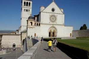
Leave Porta Cappuccini on Via Eremo delle Carceri. After passing through this Medieval city gate, turn left onto the trail lined by a tall row of cyprus trees. The ancient city walls can be seen to the left; after about 200 meters, pass the Assisi’s Rocca Minore on the left. After passing a picnic area with a water fountain, leave the wideearthen trail at the crossroads (km 0,25) and turn left, passing through a gate. At the fork (km 0,32), continue straight uphill, following the trail markers; at the next fork (km 2,08), climb to the right. The trail becomes gradually steeper and the view opens up over the Tescio River valley. The trail narrows through the woods, and, after about 800 meters, levels out and becomes a bit easier. At the crossroads (km 2,9), continue straight as the trail gradually ascends and descends. After the omino di pietra (km 3,48) (the stone man, where passersby traditionally leave a small stone), the trail begins to descend. At the bottom of the descent (km 4,16),cross the road and turn onto the dirt road on the opposite side. When you reach the inn (km 4,41), continue toward the building in the middle; at the corner of this building, continue right. Return to the asphalted road, and turn left until you reach the crossroads marked by a small shrine at Costa di Trex (km 4,72). Begin climbing to the right. After roughly 500 meters, continue climbing to the right along the paved road. Pass the signage for “Fonte Castellana”(610 MAMSL) and, shortly afterwards, turn left following the signage for “Col Cacione”. Continue downhill, keeping to the main road; just before the curve (km 6,02), take the mule track downhill on the right. After less than 200 meters, continue downhill to the right at the crossroads. Continue along this wide track, passing the entrance to a riserva faunistico-venatoria (km 6,49) on the right. After passing a ford (km 6,7),less than 200 meters on continue along the wide road at the crossroads, passing the trail on the right. After the descent, you will arrive at the historic Ponte Marchetto (km 7,25), where you can see the gorge of the same name. Cross the bridge and continue straight for few meters, then continue to the right towards Passo il Termine – Rocca di Postignano – Nocera Scalo. At the crossroads (km 9), turn right. Shortly afterwards you will reach Ponte Cavaliere. Though the bridge is closed, there is a lovely view of the gorge. From here, climb to the left along the rocky terrain. At the dirt road, turn right uphill. After walking about 300 meters through the woods, turn left at the crossroads. Begin the steep climb, keeping a moderate pace. As you leave the woods, the landscape becomes dominated by vineyards and olive groves. Continue, keeping the fence to your right; at the end of the climb (km 9,89), you will arrive at a farmhouse. Keep the house to your left, and turn right. After a few meters at the curve, continue uphill to the right. At the next crossroads, continue along the easy dirt road or, alternatively, follow the trail marked “51” on the left (which is more challenging and meets up with the dirt road further along). At the crossroads marked by a building (km 10,55), continue uphill along the main dirt road at the climb becomes steeper. After less than 1 km, turn left at the crossroads (km 11,35), then right at the fork, following the painted signage. The trail is quite rocky, so be careful. The view opens up quite suddenly over Assisi’s Rocca. The trail comes out onto a curve (km 11,9); continue left along the dirt road, which then curves to the right and begins to climb uphill. Pass the signage (km 13,44) for the church of Satriano on the right (about 700 meters there and back). The route continues straight and, after crossing the paved road, continues along a dirt track towards the entrance to an agritourism. Follow the signage marked “Allevamento” to the left. Pass through the land reserved for grazing (you may meet the friendly donkey who lives here), continuing through the woods until reaching the Passo Termine (km 14,4). At the crossroads, continue towards “Nocera Scalo” and begin your descent along the steep and rocky trail. At the asphalt road (km 15,57), turn left. You will see the remains of the Postignano castle above in the distance. Continue along the asphalt road, turning left on the trail at the curve, and continuing downhill along the fence of a hunting reserve. At the crossroads, take a hard right, leaving the fence behind you. Continue along the easy downhill stretch of main road, passing each crossroad. After a short steep stretch, return to the asphalt road (km 17,7). Turn left here, and, after a just a few meters, immediately right along the steep, downhill trail. After roughly 1 km, pick up the asphalt road again, then trun right towards the village Villa Postignano (km 18,54), where it’s possible to stop for the night.Pick up the route again from the shrine outside the village and continue downhill along the asphalt road, leaving the village to your left. At the crossroads at about 1 km, keep watch for the signage on the metal pole and turn left towards an industrial park. Cross the bridge over Caldognola River (km 20,7). After 200 meters, where the main road curves, take the railroad underpass and follow the road which spirals uphill, continuing along the railroad tracks, keeping them to your left. Continue along the dirt road as it gradually becomes steeper. At the end of the climb, you will reach the Chiesetta della Madonna dell’Africa (km 22,7). Continue straight, taking moment to admire the view over the city of Nocera and Mount Pennino. Descend along the asphalt road, passing the cemetary. At the valley floor, cross the road near Largo Felice Bisleri, passing the fountain of the same name. Pass through Porta San Francesco (km 24,3) to reach the center of town, continuing towards Piazza del Comune and the Chiesa di San Francesco ( km 24,7), now the civic museum.
To reach Bagnara, leave from Porta San Francesco (km 25,1), passing Porta Garibaldi.Turn right, crossing diagonally the public park towards the opposite end of the square, where you will follow the road downhill towards a large parking lot. As the road levels out, pass the first parking lot and turn right at the crossroads. At the end of the climb (km 25,5) begin to descend, passing the Croce Rossa building on the right.At the intersection with the SR Septempedana (km 25,74), turn right onto the paved road, staying careful of traffic. After about 100 meters, climb to the left following the signage for “Schiagni”. At the curva(km 26), ignore the signage to the left for “Schiagni”, instead continuing straight to the second crossroads where, at the gate, you will take the dirt road to the left. Continue along this pleasant dirt road to the crossroads (km 26,55), turning left here, then downhill to the right at the next crossroads (km 26,9). Continue downhill for about 100 meters, where the trail will come out behind the Chiesa di San Giovenale at Case Basse,where you will also find a water fountain. Continue straight until reaching the intersection with the SR Septempedana (Km 27,1), where you will turn left. After roughtly 100 meters, turn right over the bridge, then immediately left on the uphill dirt road. At the crossroads near a house(km 27,3), turn left onto the trail which climbs into the woods. Begin a steep stretch uphill. After a series of curves, keep close watch for the trail markings, leaving the wider trail to climb along a steep, winding trail through the woods to the left. After about 300 meters, you will come out onto a wide dirt road. Continue climbing to the left towards the ruins of La Romita. Turn back around along the same dirt road downhill, and, passing the crossroads where you have just come out, continue on to the next crossroads (km 28,2), where you will take a hard left downhill. Near the village of Le Cese(km 28,7), continue downhill along the asphalt road. After crossing the bridge spanning the Topino River, continue to the intesection with the SR Septempedana (km 29), where you will turn right and continue along this road. After less than 1 km, before the curve, turn right onto the gravel road which runs past a quarry (km 30), being careful of passing trucks. Pass the second entrance to the quarry (km 30,7) , continuino uphill. After less than 400 meters, you will reach the village of Aggi (km 31). Take a moment to see the beautiful frescoes decoratine the chiesa parrocchiale. Leaving the church to your left, continue along the road downhill. At the crossroads (km 31,4), the road curves to the left and pics up the SR Septempedana again. Instead, continue along the dirt road on the right at the curve. At the ruins of the mill, there is a water fountain (km 31,7). Return to the SR Septempedana, turning right. In less than 1 km, you will reach the village of Bagnara, where we recommend contacting the welcoming Comunanza Agraria for information regarding the area. Nearby there are the springs of the Topino River (km 32,2).
Franciscan Sites
Chiesa di Satrino
This tiny church was built in 1926 by the Compagnia dei Cavalieri on the site where the village of Satriano once stood. According to the Franciscan Sources, when the citizens of Assisi heard that Saint Francis was dying, they sent a delegation of knights to form a solemn procession, transporting the saint back to the town of his birth. The procession carrying Francis stopped along the return route at Satriano. Hungry, they sought sustenance, but could find no food to buy. Francis told them, “’If you have found nothing, it is because you have put more faith in gold than in God. Return to those homes which you have just visited, and humbly beg for alms, offering only the love of God as payment. And do not consider this as shameful or humiliating.’ The knights put aside their pride to gladly beg for that which could not be exchanged for gold, but only for God’s love. The poor citizens, moved and inspired by God, generously offered their food and their hearts. Thus, Francis’ poverty satisfied a need where gold could not.” (FF 665). To commemorate this journey, each year in September a large group of horsemen (and women) retrace the route taken by the dying saint from Nocera to Assisi.
Nocera Umbra
Saint Francis visited Nocera a number of times, as the city was at an important crossroads along the historic Via Flaminia towards Fano, and an alternative route for the March of Ancona. The saint was also friends with Saint Rinaldo, bishop during Francis’ life and now patron saint of Nocera. Rinaldo was one of the seven Umbrian bishops who, on August 2, 1216, participated in the promulgation of the Porziuncola Indulgence by Honorius III. To memorialize the passage of Saint Francis in Nocera, one of the Medieval city gates is dedicated to his name. There are also the remains of the Franciscan convent “La Romita” along the route. For information regarding local Franciscan history and sites, contact the parish priest, Don Angelo Menichelli.
Bagnara
The Franciscan Sources contain a number of passages recounting how Francis was taken to this area to find comfort for his physical suffering through the mild climate and curative waters here. It was here that the knights of Assisi came to meet Francis, taking him back to die in his hometown, as he requested. Aside from the historic sources, the local population continues their deep affection for the saint even today. To hear more about the saint’s ties with this place and for information regarding local Franciscan sites, contact Comunanza Agraria (Lorenzo Perticoni 338.4369829).
Other Sights
Costa di Trex
A hamlet with an odd name (possibly from the contraction of “Costa di tre chiese”), where the pretty 11th century Chiesa di Santo Stefano is located. Nearby, the Fonte del Sanguinone, documented from 1128, still provides water to the nearby houses, after having done so for centuries for the town of Assisi, thanks to a Medieval aqueduct more than 9 km long, some remains of which can be seen along the route.
Rocca and Villa di Postignano
Only ruins remain of La Rocca, what was once the castle of the Counts of Nocera. Here Saint Rinald, bishop and patron saint of Nocera, was born. The hamlet of Villa—still inhabited–was once the castle’s farmland
Nocera Umbra
The waters of Nocera have been reknowned for their purity, freshness, and curative powers since antiquity, lending the city of Nocera the title Città delle Acque. Nocera sits atop a hill dominated by the Campanaccio, a historic tower marked by a violent history. After the disastrous earthquake in 1997, much work has been done to restore the elegant old town. The Pinacoteca in the Chiesa di San Francesco holds a number of those small artistic masterpieces which characterize Italy (for those interested, don’t miss the beautiful Santa Casa di Loreto fresco, a reminder that pilgrims headed to Loreto would pass here). The interesting Museo Archeologico and Duomo arealso worth a visit.
Bagnara
The life of this small village revolves around the pretty Chiesa di sant’Egidio and the Università degli uomini di Bagnara. This latter organization, founded in 1343, is dedicated to the conservation of this land and its traditions. We recommend contacting members to hear stories of local history as only those who truly love their land can tell them (for contacts, see Bagnara – Villaggio Sostenibile).
Aggi
Along the pilgrim route, Aggi’s Chiesa di Santa Lucia has beautiful frescoes by Matteo da Gualdo (to visit, contact Lorenzo Perticoni: 338.4369829).
© FRANCESCO'S WAYS | Privacy Policy | Crediti