info@francescosways.com +39 0758241011
info@francescosways.com +39 0758241011


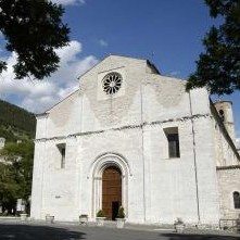
Leave from Piazza Quaranta Martiri: at the southern end of the piazza, turn left onto Via Campo di Marte. Continue on Viale della Rimembranza until reaching the marked intersection with Viale Manzoni, where you will turn right. After the Chiesa della Vittorina (km 1), cross the park and first turn right and then left onto Via Piaggiola (km 1.33). Continue on the level asphalt, passing a simple church (km 3.45), once part of an ancient leprosarium where Saint Francis lived caring for lepers (cf. FF 1045). At the intersection, cross the busy street keeping watch for traffic. Continue along the Strada Assisana on the pedestrian shoulder. At the curve (km 6.04), turn right onto a secondary road instead of taking this dangerous curve. Go back to the busy road (km 6.68) and continue toward the right, taking care when crossing the Provinciale (km 6.91). From here you will continue along a quiet secondary road which gradually climbs. After an agritourism (km 8.28), there is a short, steep climb. At the top of the hill (km 9.6), take one last look at Gubbio behind you before continuing on to the Chiascio River Valley and the hilltop castles above. On clear days, you can see the top of Monte Subasio in the distance. Around 150 meters after passing an abandoned farmhouse (km 14.2), you will reach a water fountain. Shortly afterwards, you will pass the Chiesetta delle Ripe or Madonna delle Grazie (km 14.46), inside of which there is a small book where pilgrims can sign. Begin climbing through a conifer wood to Eremo di San Pietro in Vigneto (km 16.54); there is a water fountain nearby. The track here has rough, rocky stretches. At the signage (km 17.62), turn right onto a path. Near the pillars of the aqueduct, keep watch for the painted signage to avoid passing through the stream. Cross the ford (km 18.25); this is the beginning of a tough, steep climb which is slippery when wet. At the end of this climb (km 19), you will reach the Chiesa di Caprignone (km 19.86), which is a cool place to stop and rest. Continue on the trail to the left. Cross the stream and continue the long, steep climb along the narrow trail, pacing yourself. At the asphalt road (km 21.65), turn left. Continue, finally, along a level stretch to Castello di Biscina (km 22.7). From here the route continues downhill.
At the gate of an abandoned castle, begin to descend along the wide tractor track to the left. At the fork (km 24.2), there is a water fountain on the left. In this section of the leg, there will be long stretches under the direct sun and the wide expanse of water from the Chiascio dam dominates the view. At the fork (km 26.3), begin descending to the left, first along a tractor track and then down a stretch of wooden stairs. Pass the creek and then begin to climb the steep trail along the stream. At the asphalt road (km 27.42), turn downhill at the ruins of an old farm building. The route continues downhill, with short stretches climbing gradually, until Valfabbrica. Cross two bridges, staying on the asphalt road. At the marked crossroad for Sambuco and Coccorano (km 29.3), those who want to visit the small church at Coccorano (about 1.5 km) can trun right. Othewise, continue for around 2 kilometers, where the yellow and blue Saint Francis’ Way signage picks up again. Descend to the bridge, where you will turn right for La Barcaccia (km 31.7). After the Chiesa di San Benedetto, continue along the tractor track until reaching Valfabbrica (km 35.4).
Contacts:
IAT di Gubbio
P.zza Oderisi, 6 – 06024 Gubbio
Phone: 0759220693 | Fax: 0759273409 | info@iat.gubbio.pg.it
© FRANCESCO'S WAYS | Privacy Policy | Crediti